Site Overview & Regional Context
General-purpose maps showing the overall project boundary and its relationship to surrounding roads, rail, and landmarks.
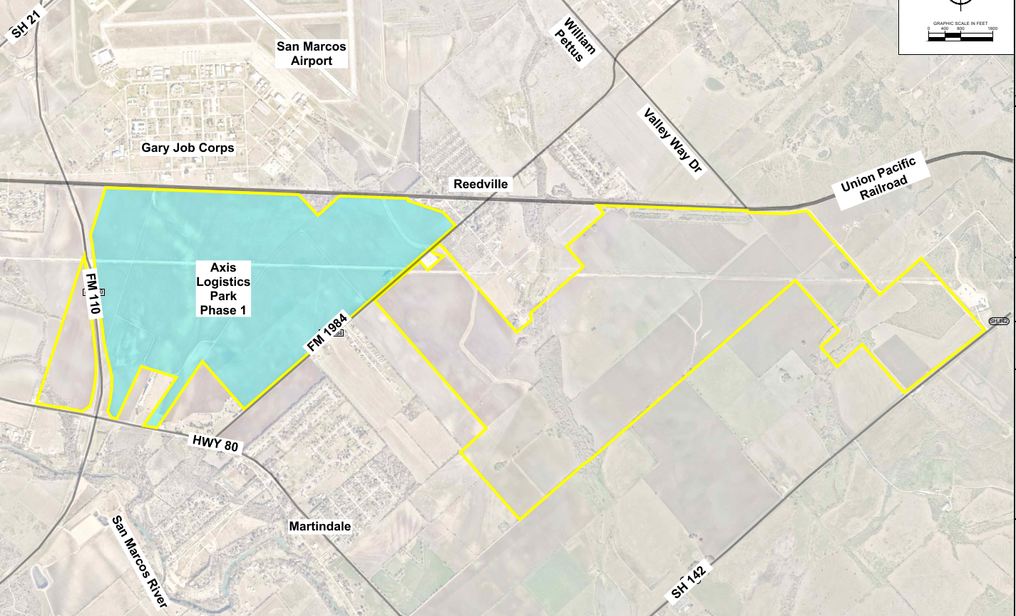
Axis Logistics Park - Phase 1 Aerial Overview
Aerial view of the Phase 1 boundary (teal) relative to San Marcos Airport, Gary Job Corps, Reedville, Martindale, FM 110/1984, and the Union Pacific Railroad.
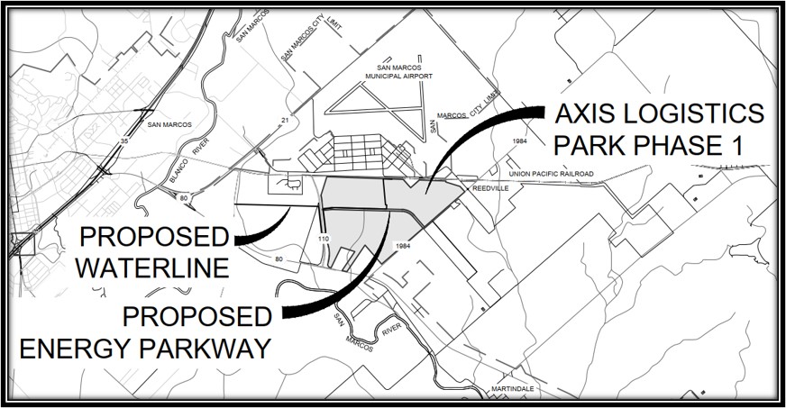
Phase 1 Overview - Proposed Waterline & Energy Parkway
Regional overview map labeling the proposed waterline and proposed Energy Parkway relative to San Marcos, the Blanco River, San Marcos Municipal Airport, Reedville, and Martindale.
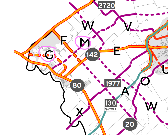
Regional Context Map - Lettered Subarea Zones
Wider regional road map (SH-80, FM 142, FM 1977, SH-130 Toll, IH-35) with circled zones labeled F, G, M, W, V, E, O, A, X, apparently marking landowner or planning subareas near San Marcos.
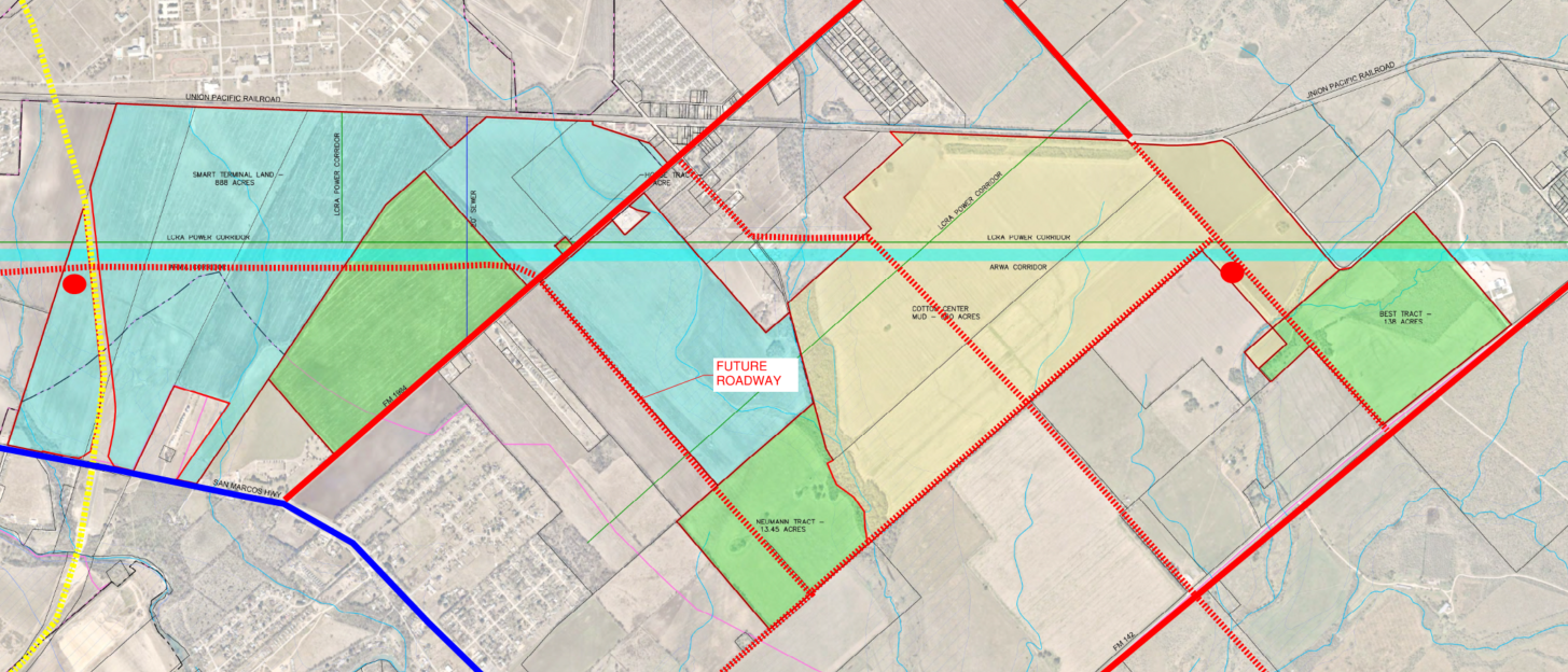
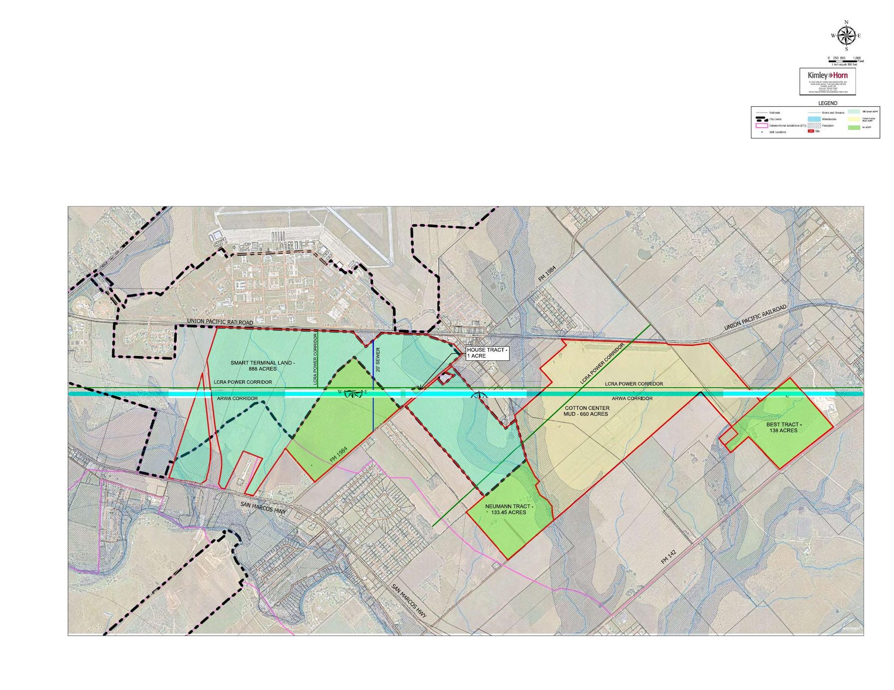
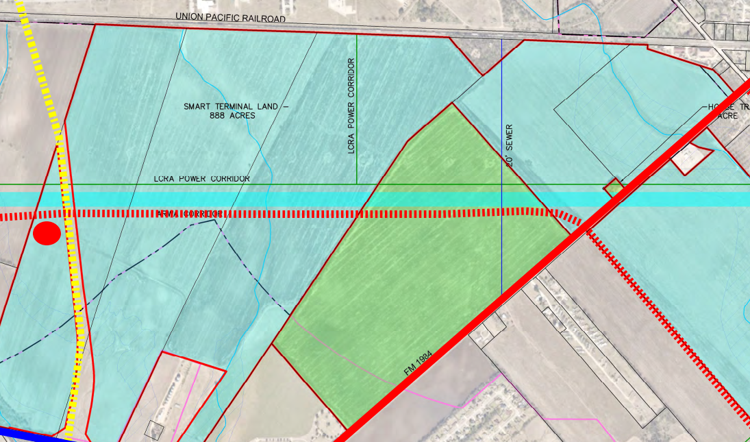
"SMART Terminal Land - 888 Acres" Exhibit (v.A)
Color-coded parcel exhibit labeling the original 888-acre SMART Terminal tract, Neumann Tract, Best Tract, Cotton Center MUD, LCRA power corridor, ARWA corridor, and a future roadway.
Division Map
Overall parcel division map for the site.
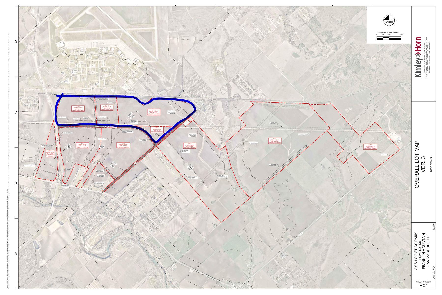
Overall Lot Map (Ver. 3)
Site-wide lot layout exhibit.
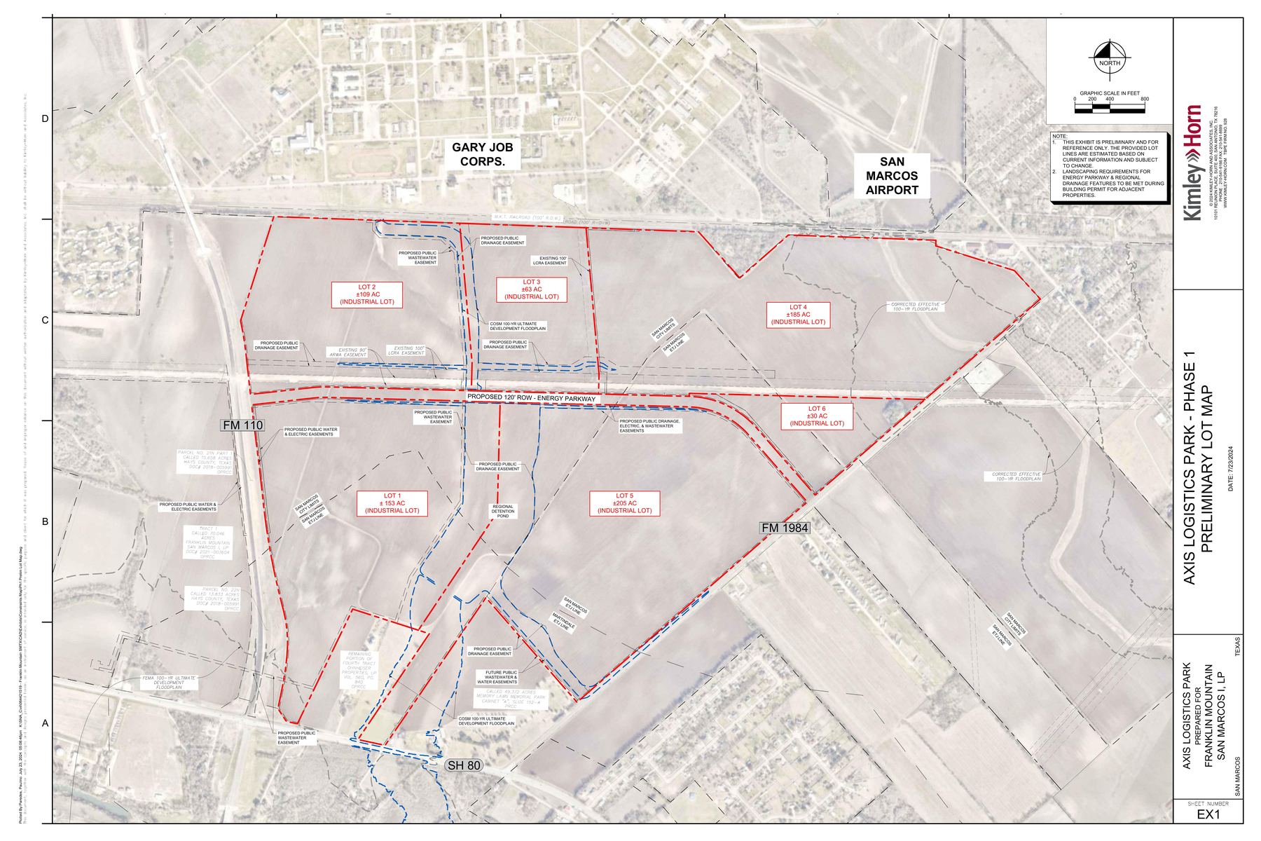
Phase 1 Preliminary Lot Map
Preliminary lot layout for Phase 1 of the development.
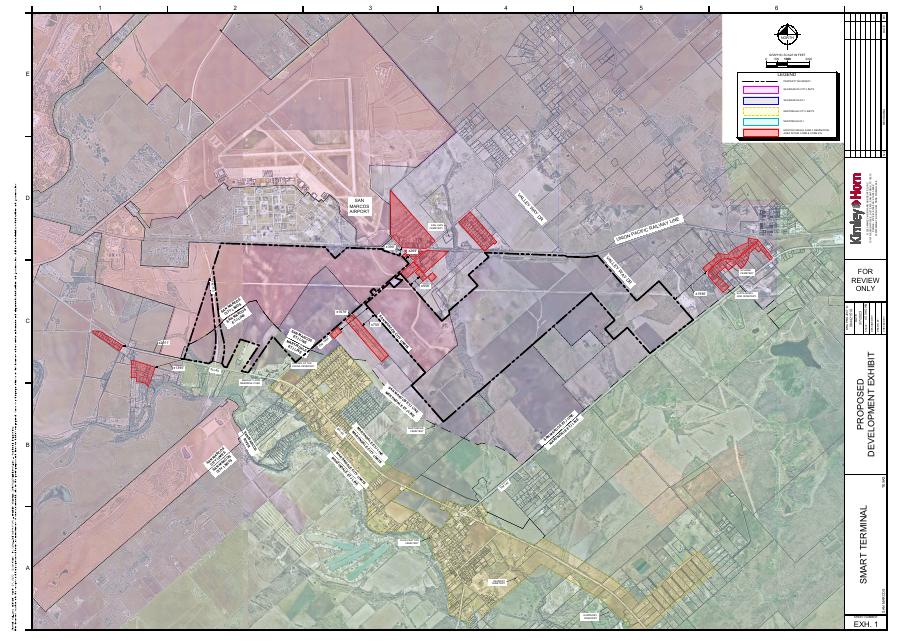
SMART Terminal Map - Scarborough Lane Dev.
Developer-produced site map from Scarborough Lane Development.
Land Use, Zoning & Phasing
Exhibits from the 2023 Development Agreement and its administrative amendments governing permitted land use, project phasing, and lot configuration.
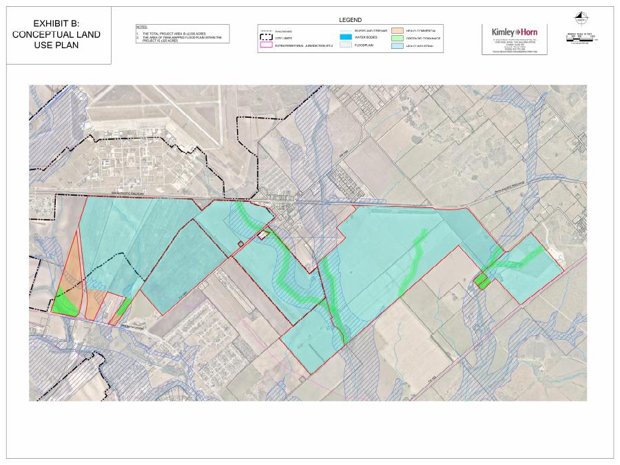
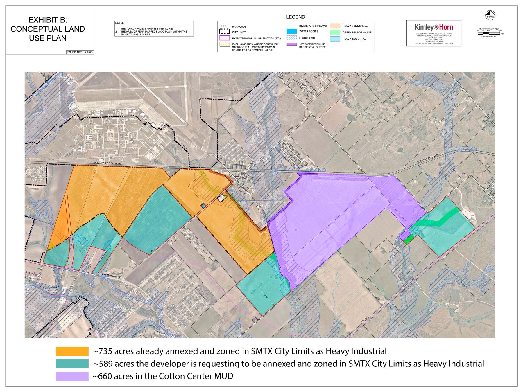
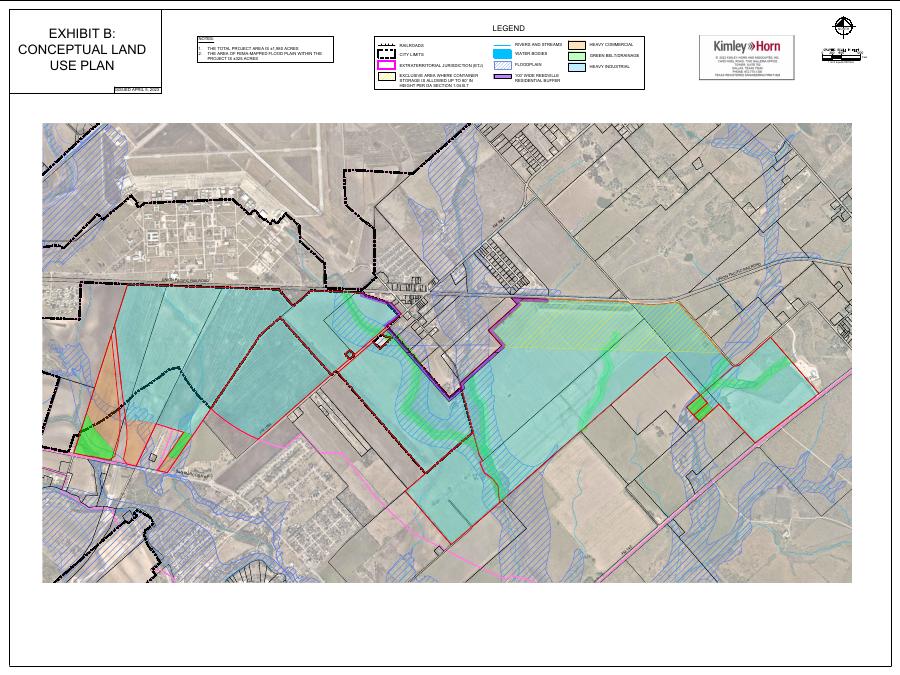
Exhibit B: Conceptual Land Use Plan
Development Agreement Exhibit B - heavy industrial / heavy commercial land use zones, floodplain, the 100' Reedville residential buffer, and the container-storage-height exclusive area.
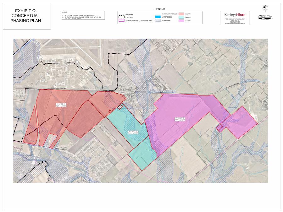
Exhibit C: Conceptual Phasing Plan
Phase 1 / 2 / 3 boundaries, detention basins, drainage channels, and floodplain across the ±1,980-acre site. (Also featured on the homepage.)
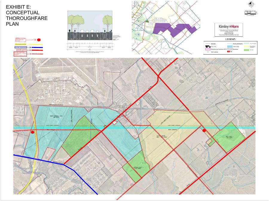
Exhibit E: Road Plan
Development Agreement road-network exhibit.
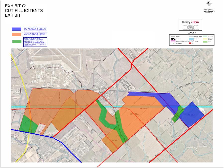
Exhibit G: Cut-Fill Extents
Areas permitted up to 20-ft and 15-ft of cut/fill with administrative approval, and anticipated floodplain limits requiring a detailed study.
Color Exhibits - Minor Amendment
Color exhibit set attached to a minor amendment of the Development Agreement.
PDA-22-07 - Location Exhibit
Location exhibit filed with development plan amendment application PDA-22-07.
Roadway, Utility & Annexation Exhibits
Right-of-way, roadway alignment, annexation, and public infrastructure exhibits filed with the City of San Marcos.
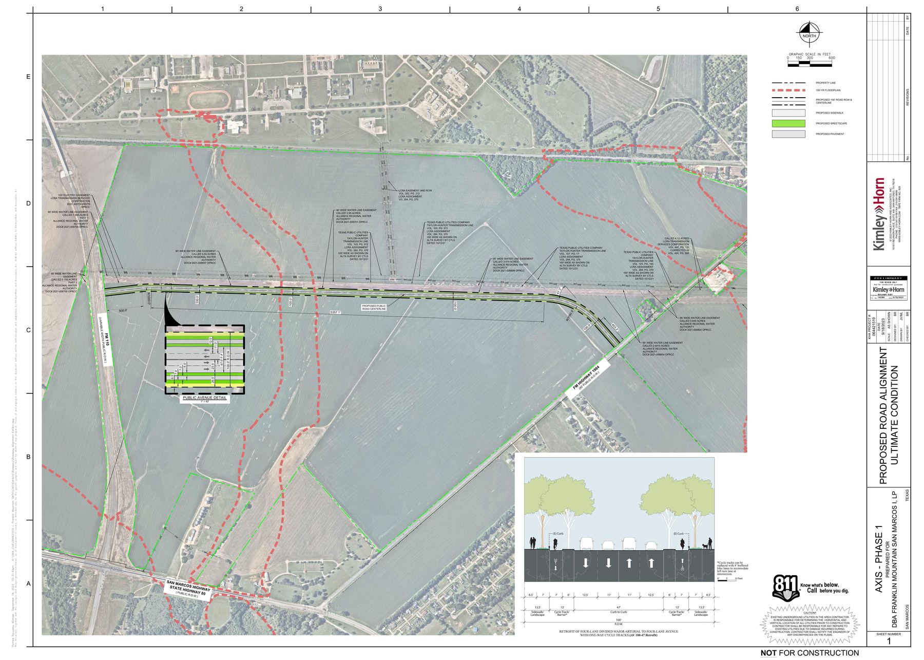
Roadway Alignment Exhibit - Ultimate
Ultimate (build-out) roadway alignment exhibit for the site's internal and connecting road network.
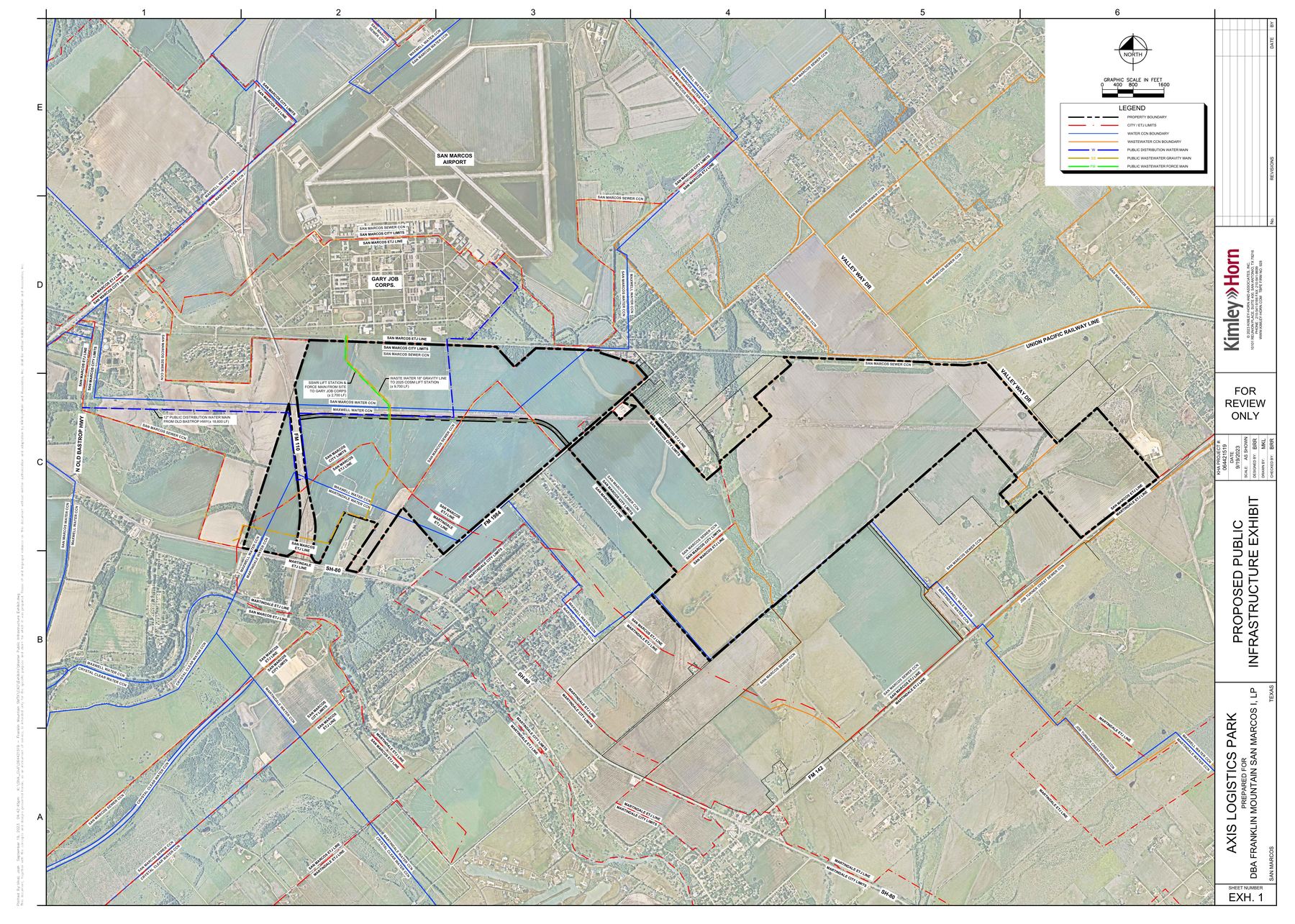
Proposed Public Infrastructure Exhibit
Site-wide exhibit of proposed public infrastructure (roads, utilities) to be dedicated to the City.
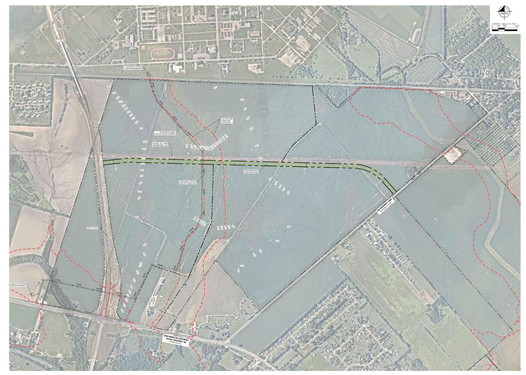
Sanitary Sewer Planning Exhibit
Planning-level sanitary sewer routing exhibit for the site.
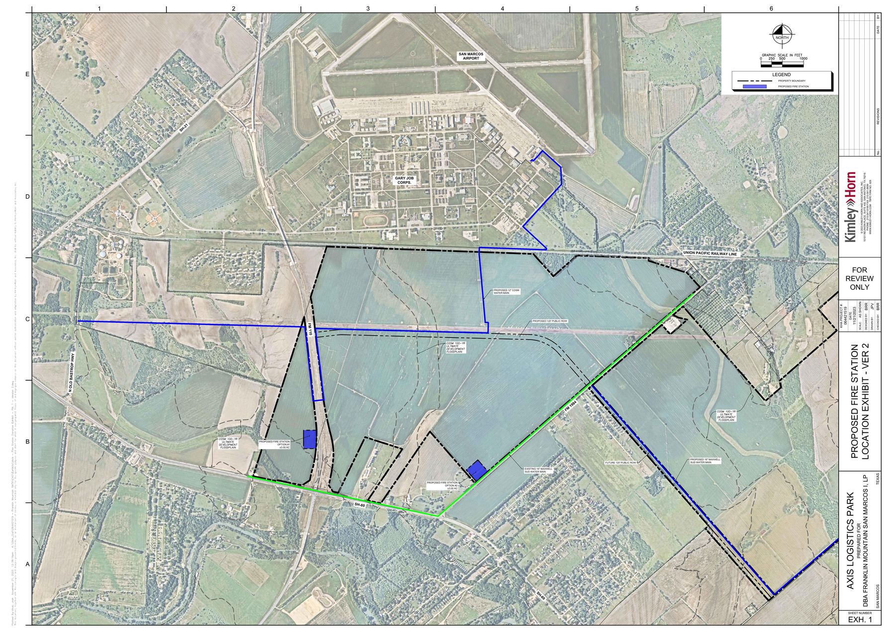
Proposed Fire Station Location Exhibit
Exhibit identifying a proposed on-site or nearby fire station dedication site (Ver. 2).
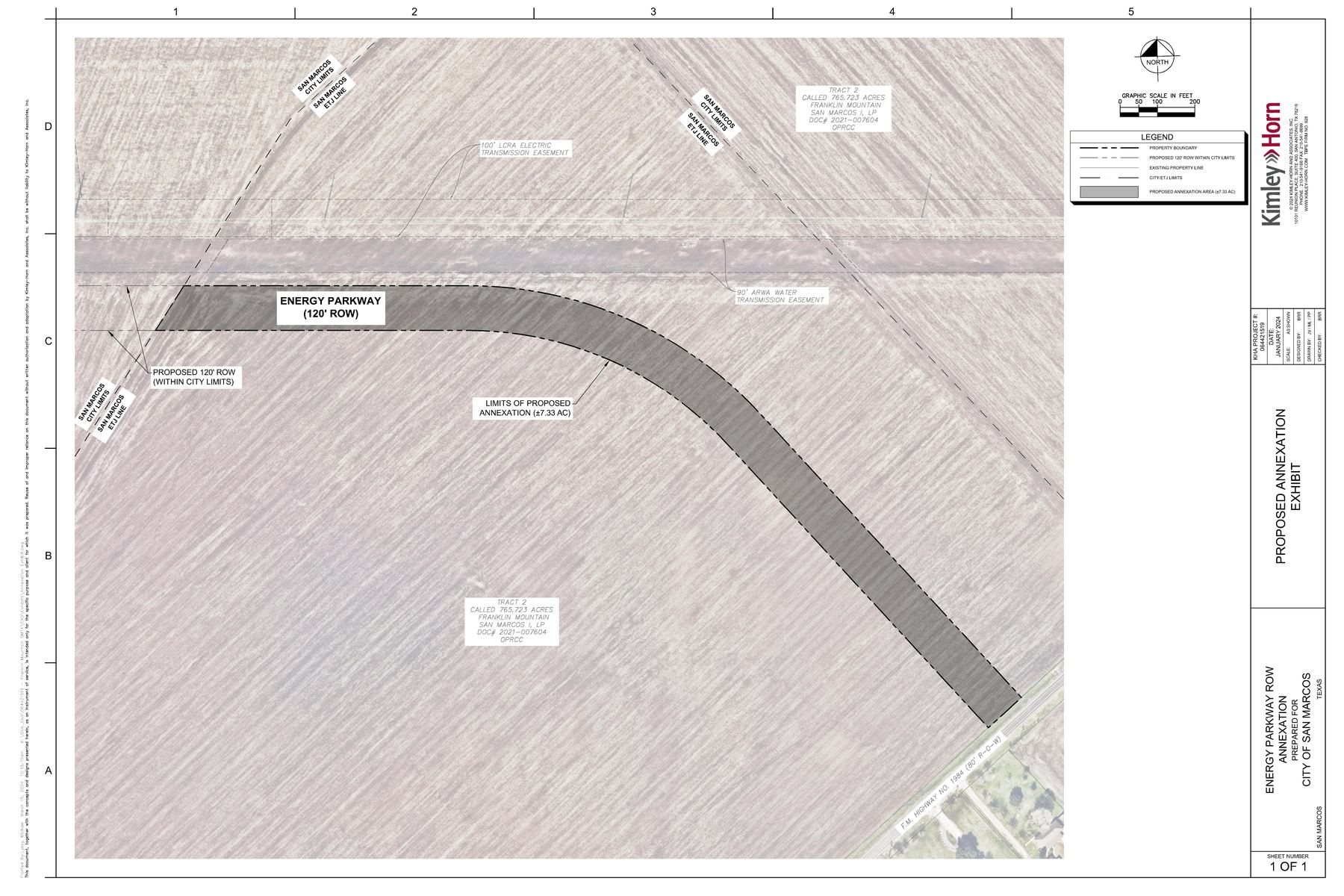
AN-24-03 - Proposed Annexation Exhibit
Proposed annexation exhibit filed under case AN-24-03.
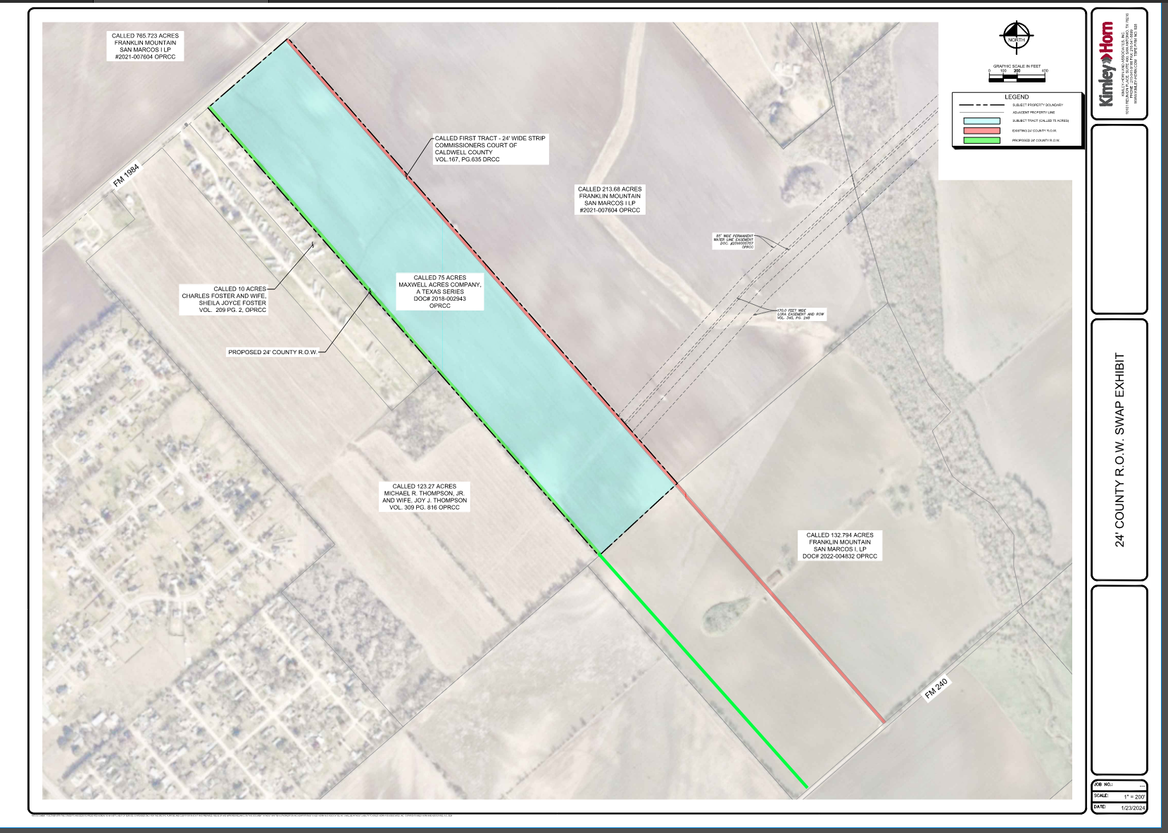
24' County ROW Swap Exhibit
Kimley-Horn aerial exhibit near FM 1984/FM 240 showing the subject tract, existing and proposed county right-of-way strips, and adjacent owners including Franklin Mountain San Marcos I LP and Charles/Sheila Foster.
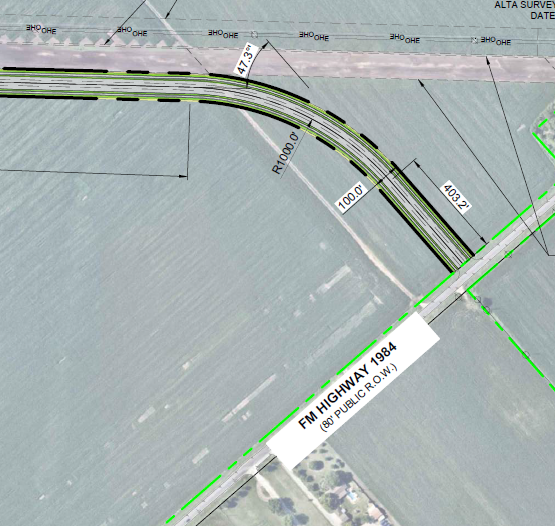
Road Curve Alignment - FM 1984 Tie-In
Aerial engineering exhibit of a 1000'-radius road curve tying into FM 1984's 80' public right-of-way, with dimension callouts and overhead electric line markers.
Water Quality, Drainage & Floodplain
Stormwater, detention, drainage-area, and FEMA floodplain studies - central to the site's wastewater/stormwater capacity questions covered in the Research Reports.
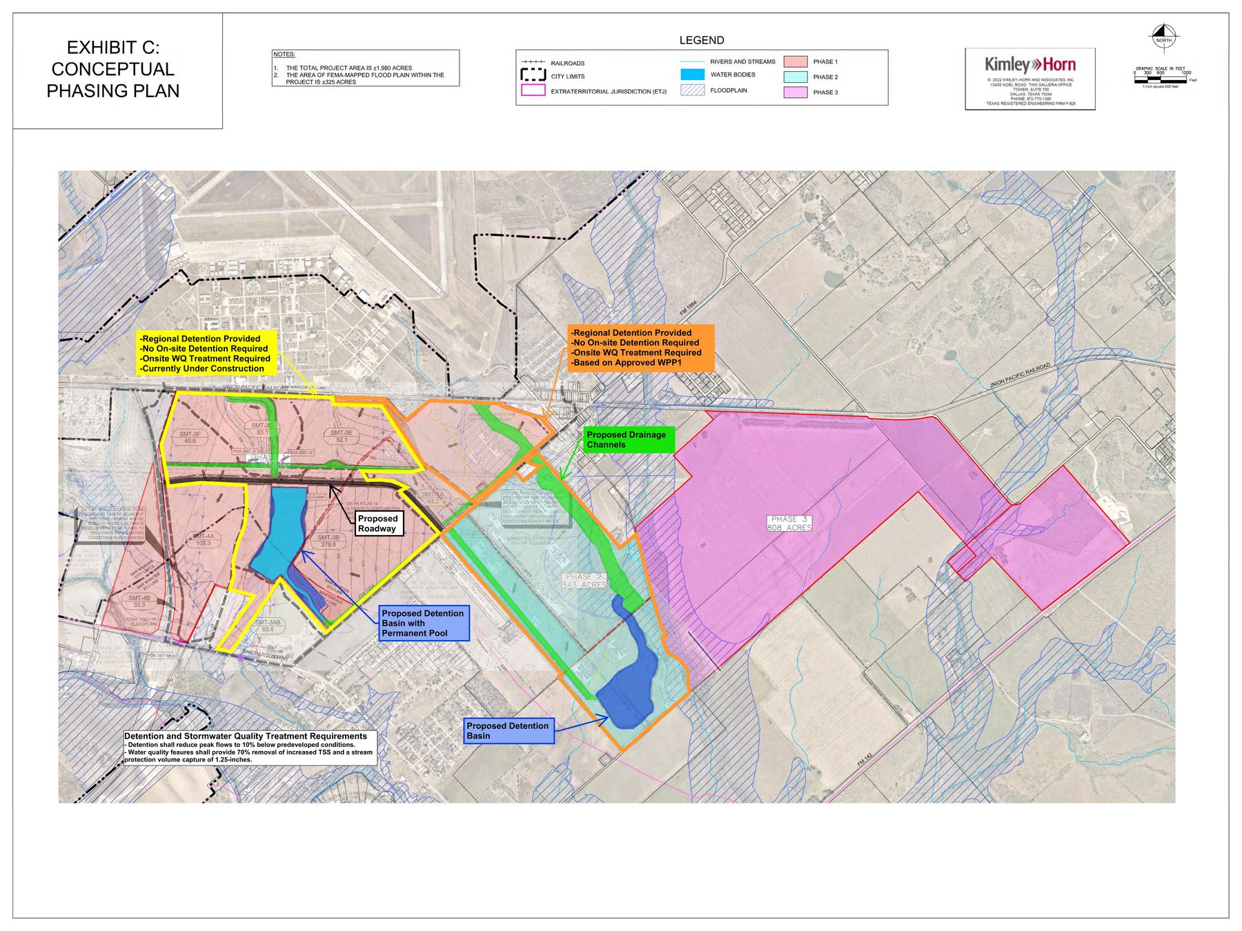
Detention & Water Quality Summary Exhibit
Exhibit C: Conceptual Phasing Plan, also shown on the homepage - phase boundaries, detention basins, and floodplain.
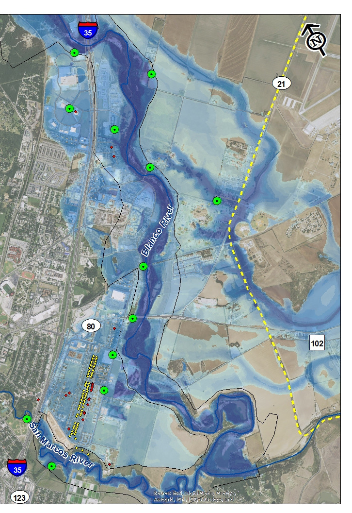
2015 Flood Map
FEMA-era flood map of the area predating the current effective floodplain study.
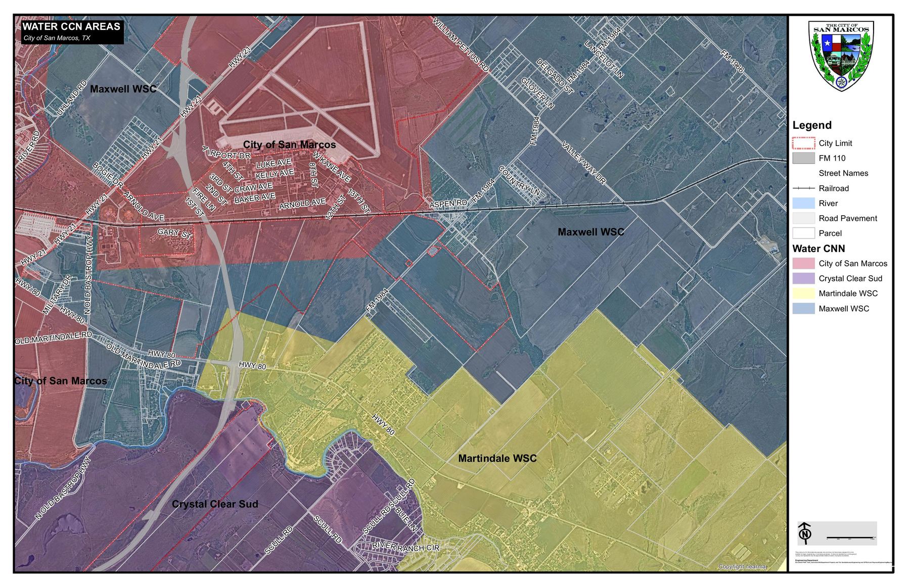
Water CCN Map
Certificate of Convenience and Necessity (CCN) service-area map for water provision to the site.
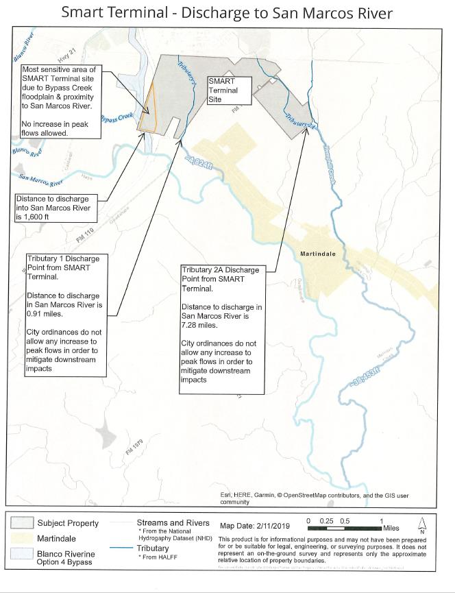
River Discharge Map
Map illustrating site stormwater discharge points relative to the San Marcos River / Blanco River system.
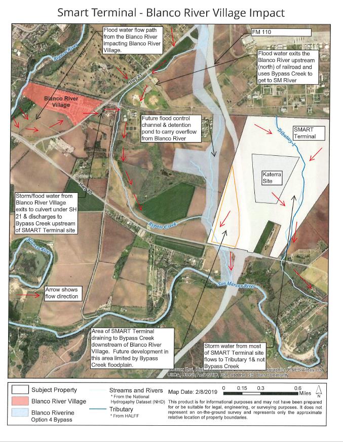
Blanco River Village Impact Map
Map assessing potential downstream impact to the Blanco River Village area.
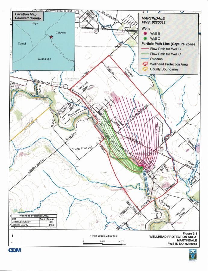
Wellhead Protection Area
Wellhead protection area boundary map relevant to groundwater near the site.
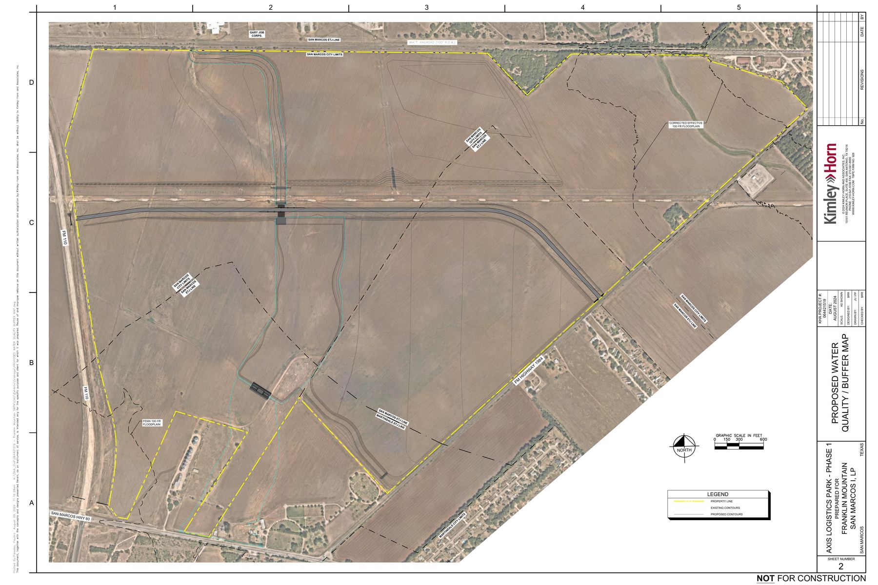
Proposed Water Quality Buffer Map
Proposed water-quality buffer zones for the site (Aug. 2024).
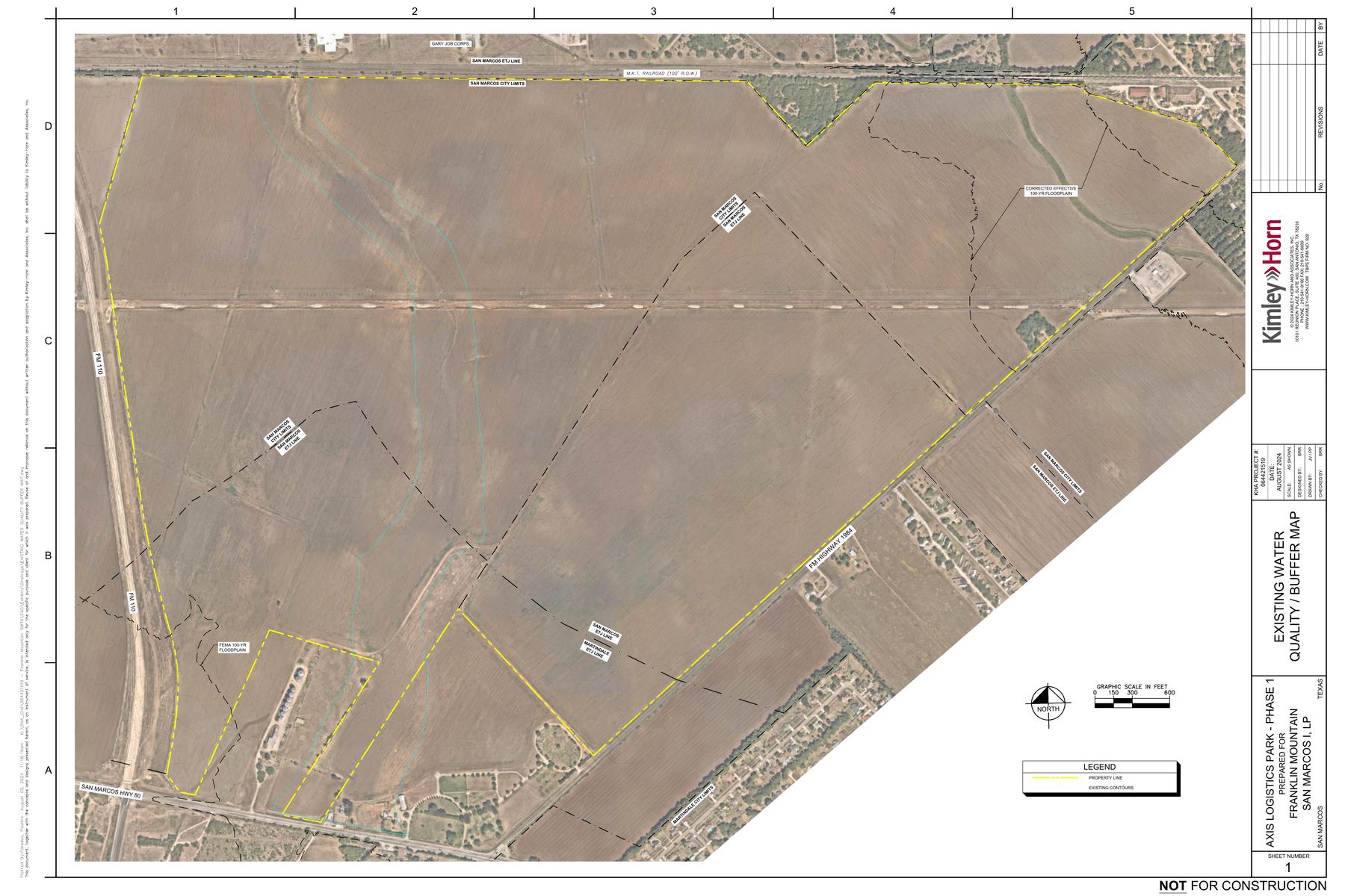
Existing Water Quality Buffer Map
Existing (pre-development) water-quality buffer conditions for comparison against the proposed buffer map (Aug. 2024).
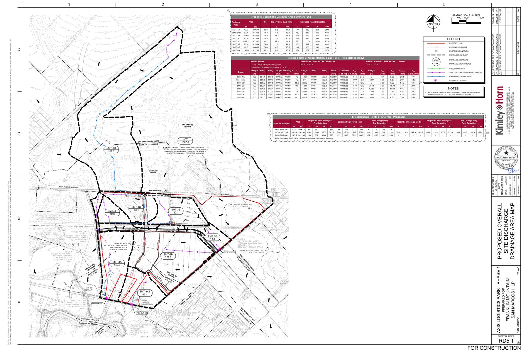
Sheet RD5.1 - Proposed Site Discharge Drainage Area Map
Kimley-Horn drainage-area map with SCS drainage-area summary tables, time-of-concentration calculations, and pre/post-detention discharge-point analysis.
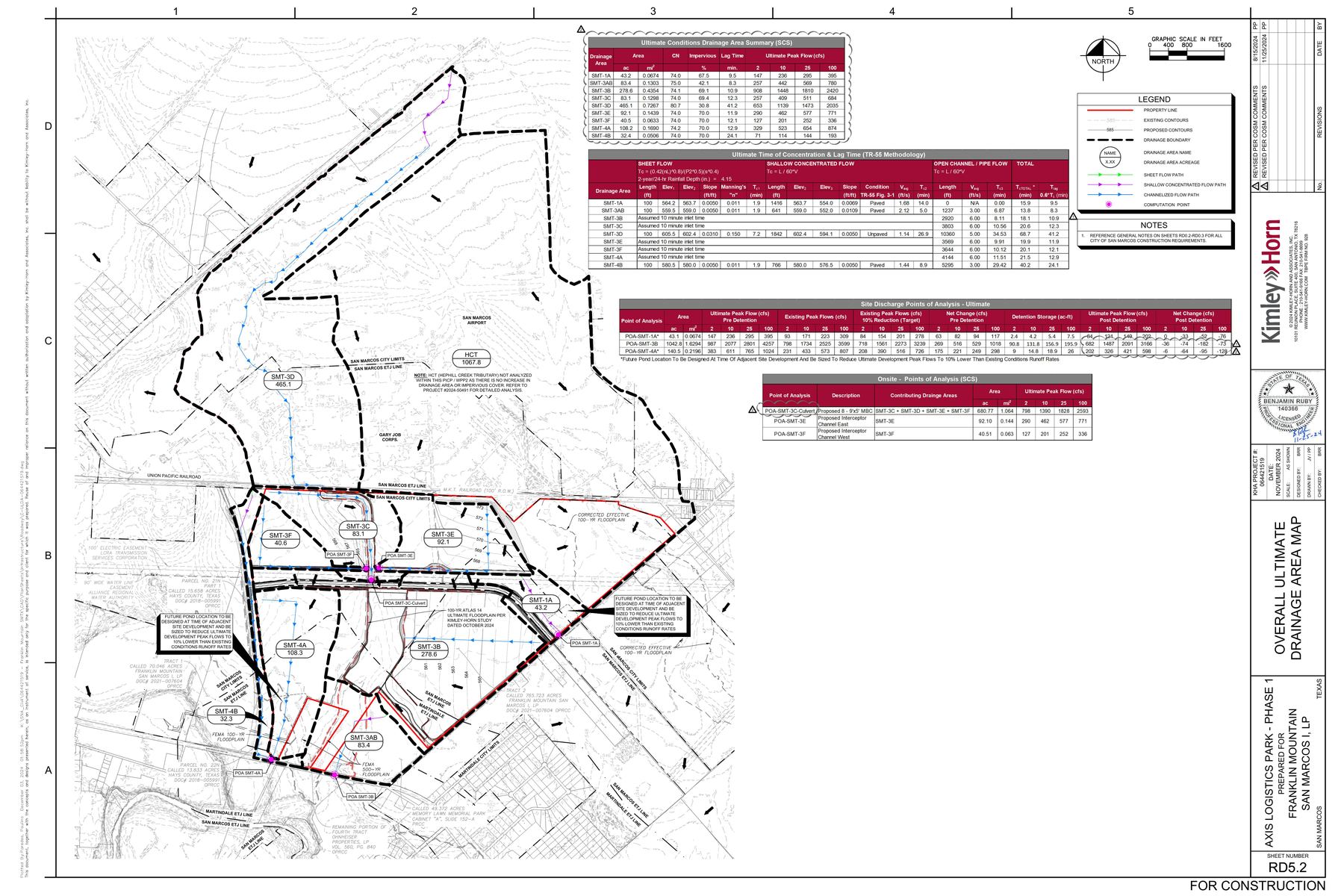
Sheet RD5.2 - Overall Ultimate Drainage Area Map
Ultimate (full build-out) drainage-area map companion to RD5.1.
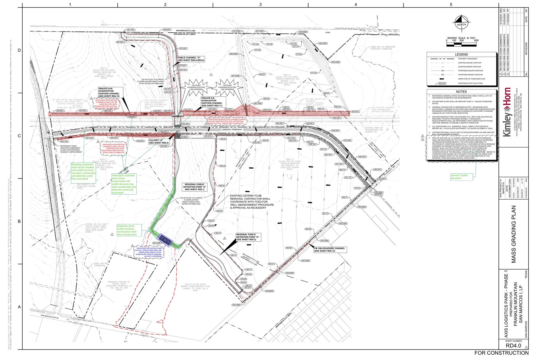
Sheet RD4.0 - Mass Grading Plan
Mass grading plan (Nov. 2024) showing interceptor channels, Regional Public Detention Pond "A," Culvert "A," and the Energy Parkway alignment, marked "For Construction."
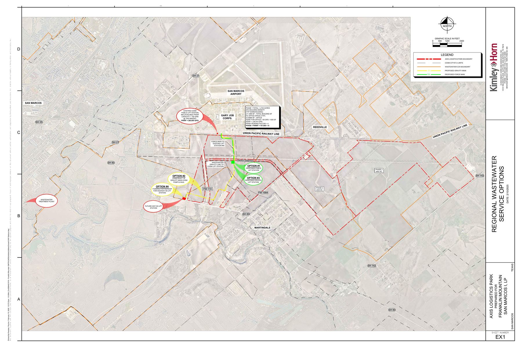
Regional Wastewater Service Options Exhibit
Exhibit comparing regional wastewater service-provision options for the site (Feb. 2025) - relevant to the wastewater capacity constraint discussed in the Research Reports.
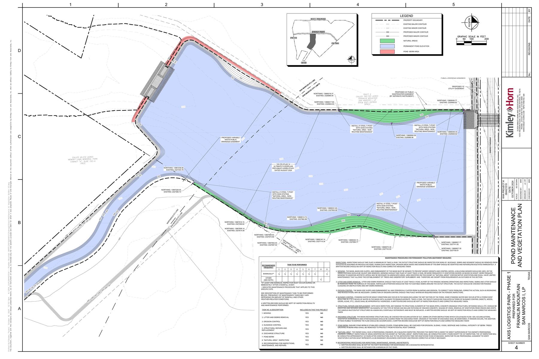
Pond Maintenance & Vegetation Exhibit
Maintenance and vegetation-management exhibit for a detention pond (Oct. 2024).
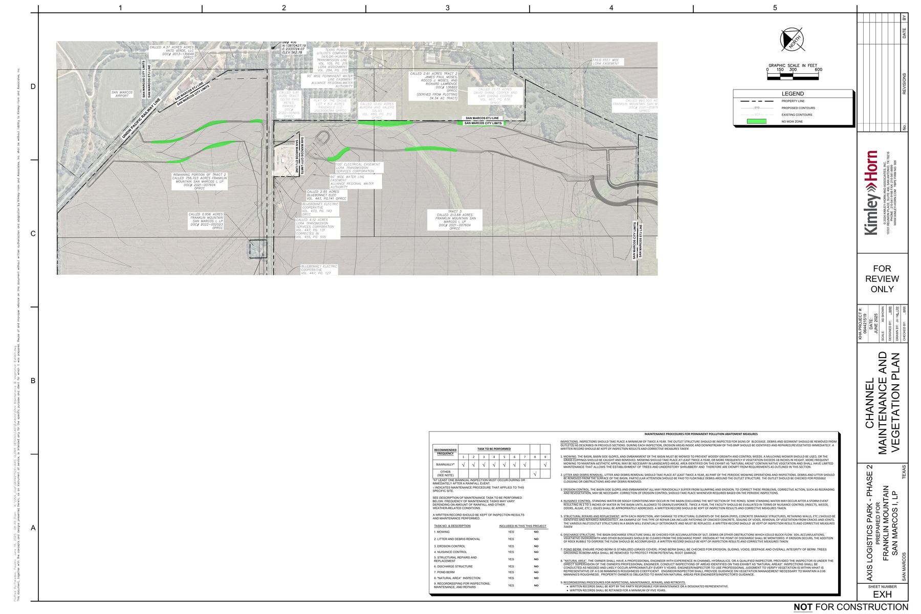
Channel Maintenance & Vegetation Plan - Phase 2
Kimley-Horn channel maintenance/vegetation plan (June 2025) for Axis Logistics Park Phase 2, with maintenance-procedure tables and Zone A/B vegetation criteria diagrams.
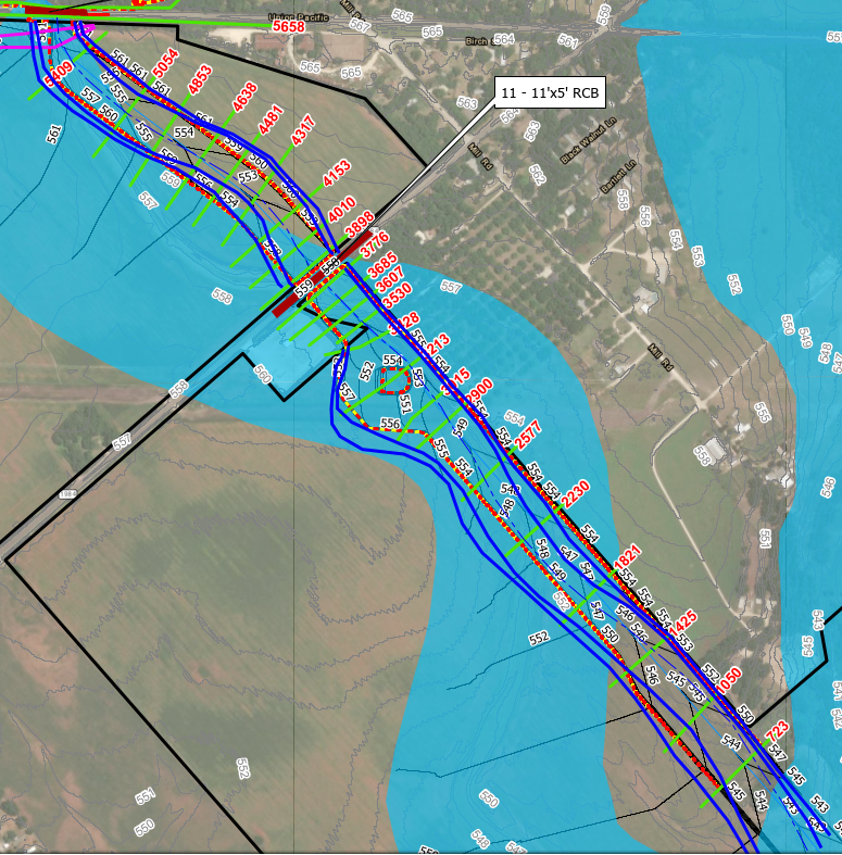
Storm Drain / Culvert Exhibit
Proposed 11-cell 11'x5' reinforced concrete box (RCB) culvert crossing near the Union Pacific rail corridor, with floodplain shading and drainage-flow arrows.
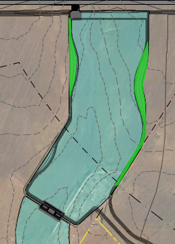
Floodplain / Drainage Corridor Aerial
Teal-shaded drainage/floodplain corridor running through agricultural parcels, with contour lines and parcel boundaries.
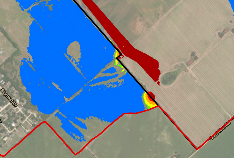
Floodplain Inundation Map - Skycrest Dr.
Close-up 100-year water-surface-elevation change (inundation) map near Skycrest Drive, part of a hydraulic model exhibit.
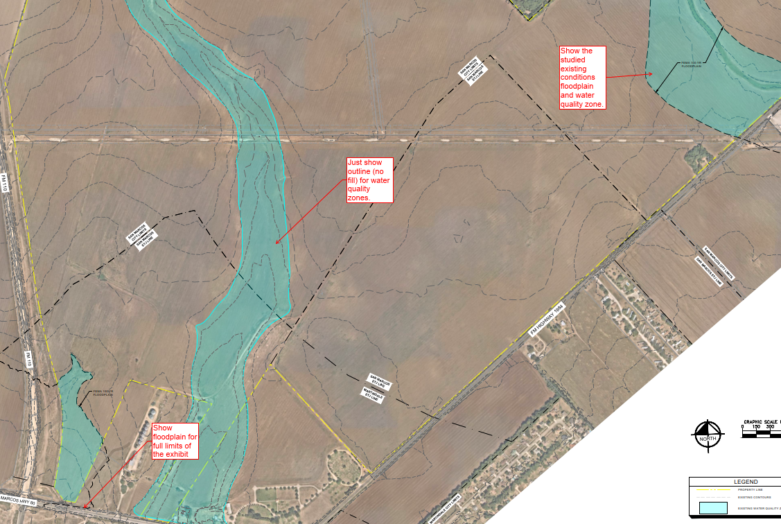
FEMA Floodplain / WQ Zone - Review Markup
Aerial exhibit near FM 110/FM 1984 and San Marcos Hwy 80 showing the 100-year FEMA floodplain and water-quality-zone contours, with red review markup comments requesting changes.
Environmental Contour Exhibit
Aerial imagery overlaid with a red study boundary and a green-yellow-red contour gradient near a body of water.
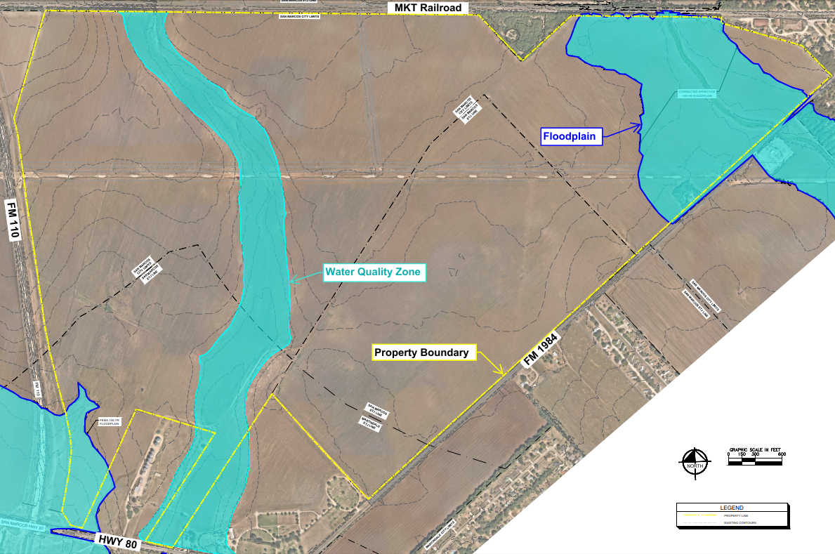
Water Quality Zone & Floodplain Overview
Aerial overview labeling the Water Quality Zone, Floodplain, and Property Boundary along FM 110/FM 1984 near the MKT Railroad.
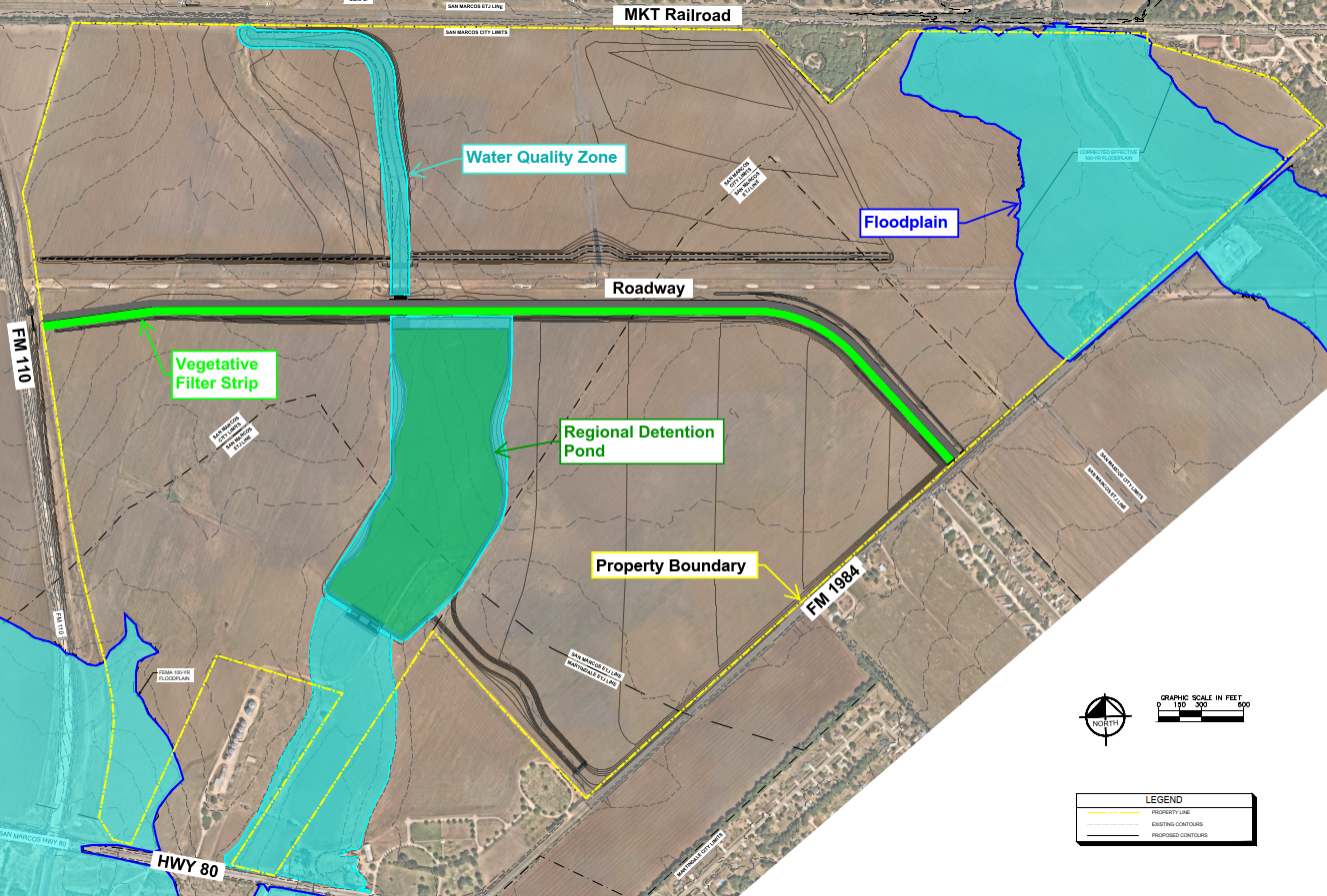
Vegetative Filter Strip & Regional Detention Pond
Detail exhibit labeling the Vegetative Filter Strip, Regional Detention Pond, Water Quality Zone, and Floodplain along the proposed roadway.
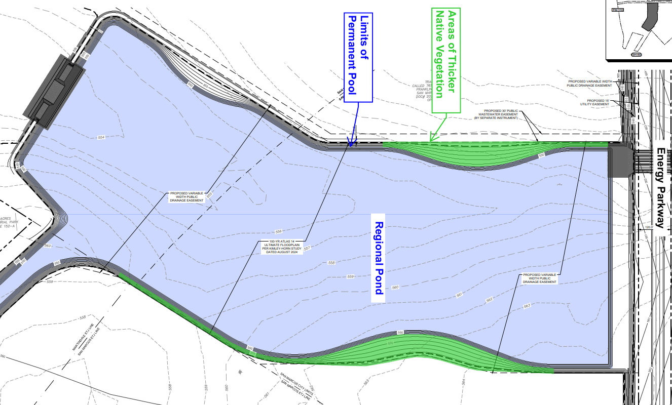
Regional Pond Detail - Native Vegetation Areas
Close-up of the Regional Pond showing Limits of Permanent Pool and Areas of Thicker Native Vegetation along Energy Parkway.
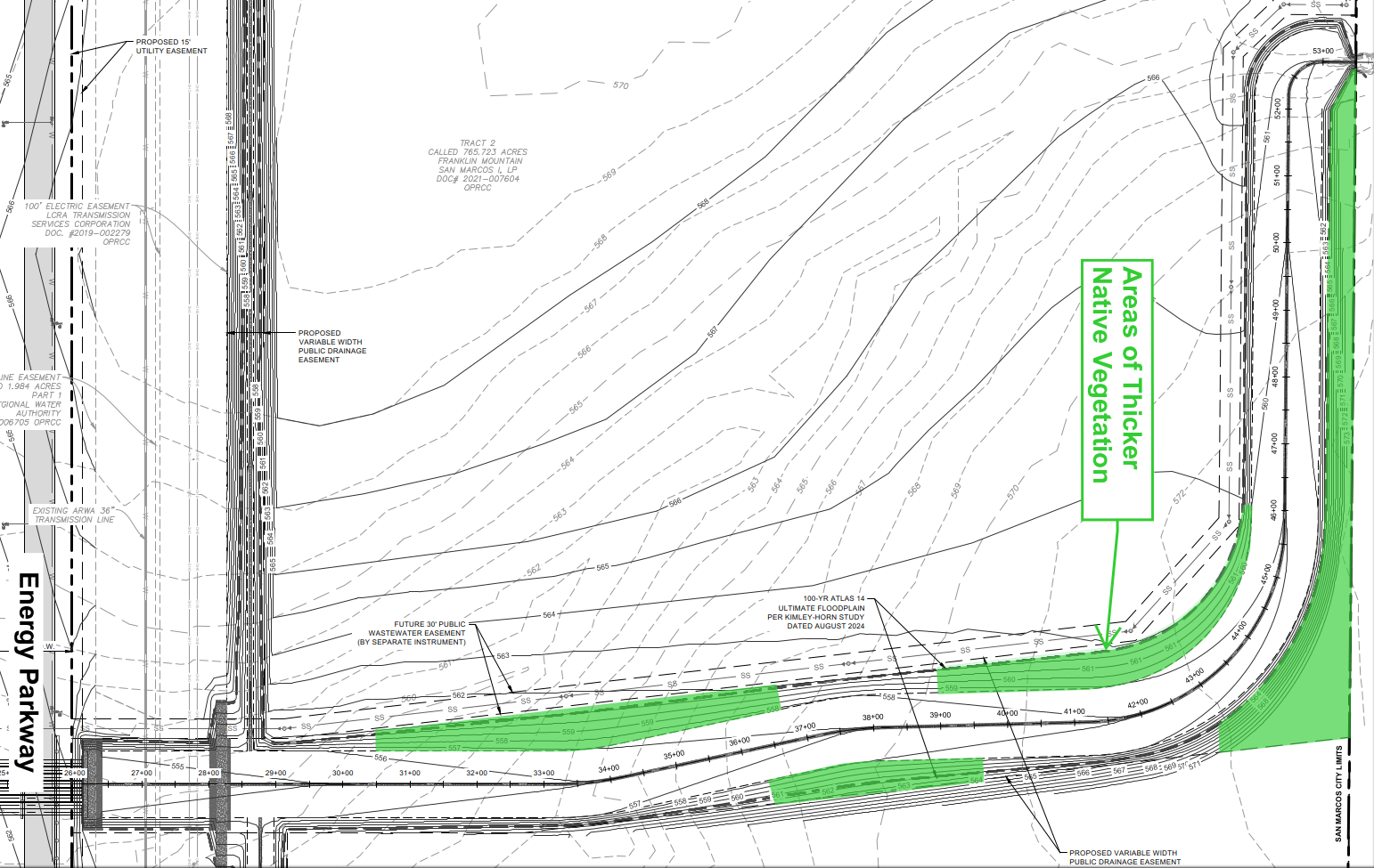
Energy Parkway - Vegetation & Easement Plan
Detailed engineering plan along Energy Parkway with contour lines, "Areas of Thicker Native Vegetation," and utility/drainage/wastewater easements referencing an August 2024 Kimley-Horn floodplain study.
Tree Preservation
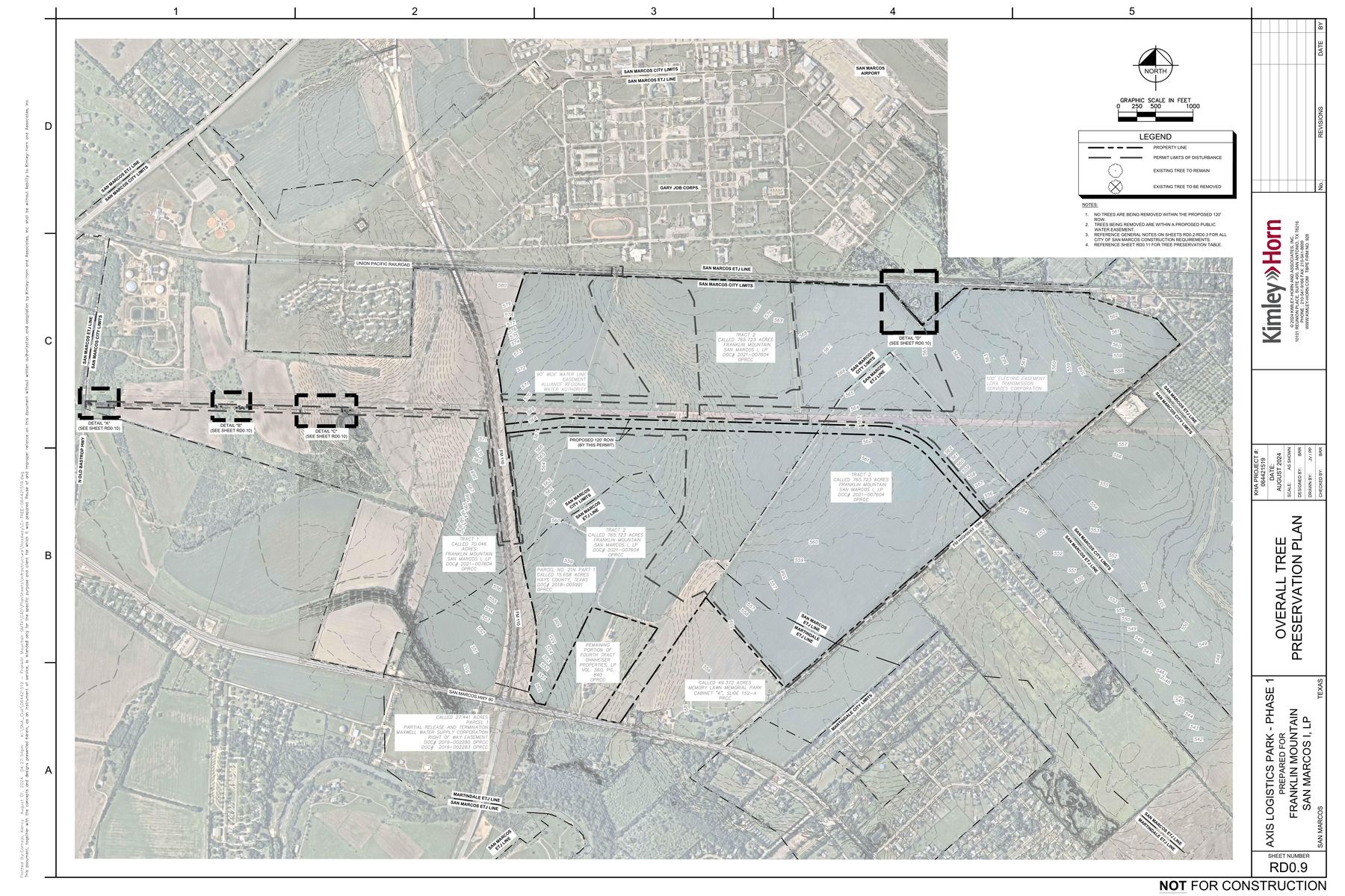
Overall Tree Preservation Plan
Site-wide tree preservation plan (Aug. 2024) marking trees to remain vs. be removed within the proposed 120' right-of-way and public water easement.
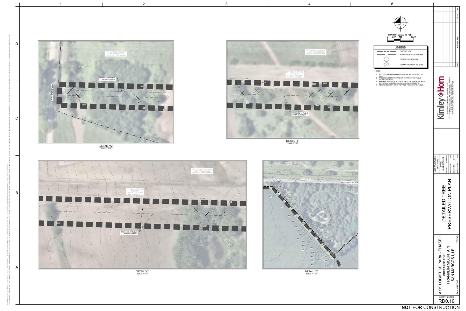
Detailed Tree Preservation Plan
Detail sheets ("A" through "D") zooming into individually tagged trees along the right-of-way and water easement corridor.
FAA & Height Restrictions
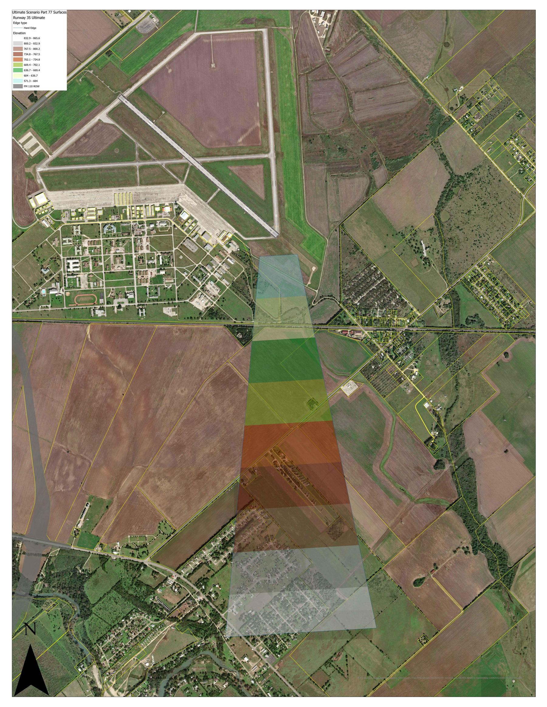
FAA Height Restrictions / Imaginary Surface Zone
FAA airspace height-restriction (imaginary surface) map relevant to San Marcos Airport proximity and the site's 80-ft container-storage-height waiver.
Groundwater Contamination - Gary Job Corps / Municipal Landfill
Exhibits from the 1995 EPA Site Inspection Prioritization Report and the 2022 Department of Labor Draft Environmental Assessment for the Gary Job Corps Center, adjacent to the project site. See the Groundwater Contamination page for full context.
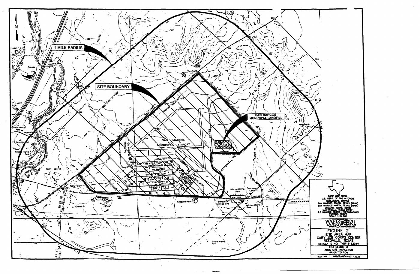
Site Area Map (1995 EPA Site Inspection, Figure 2)
Topographic map showing the Gary Job Corps Center site boundary, 1-mile radius, San Marcos Municipal Airport, and the San Marcos Municipal Landfill (hatched).
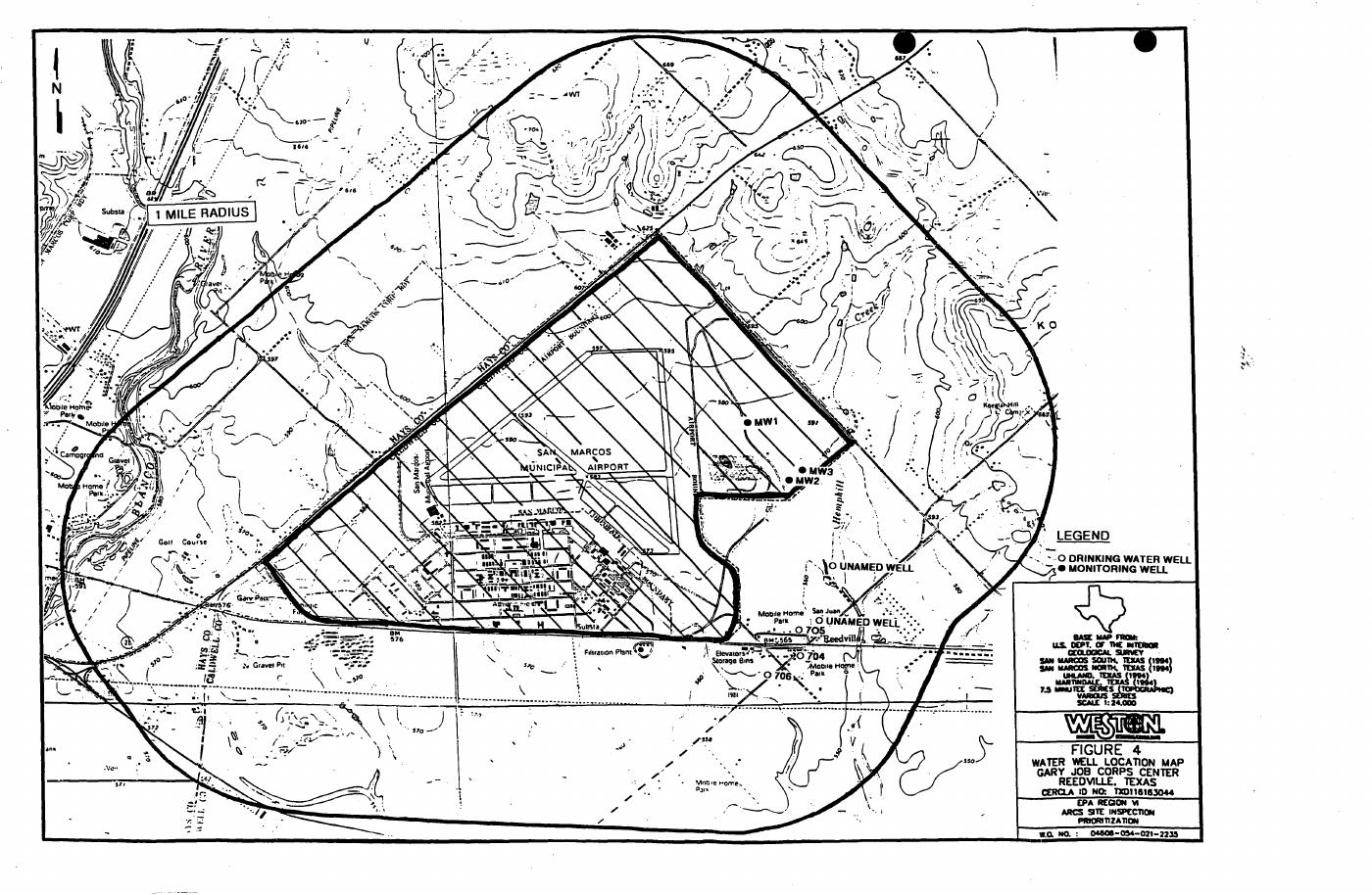
Water Well Location Map (1995 EPA Site Inspection, Figure 4)
Plots monitoring wells (MW1–MW3) and nearby drinking water wells relative to the site - the wells in which contamination was documented.
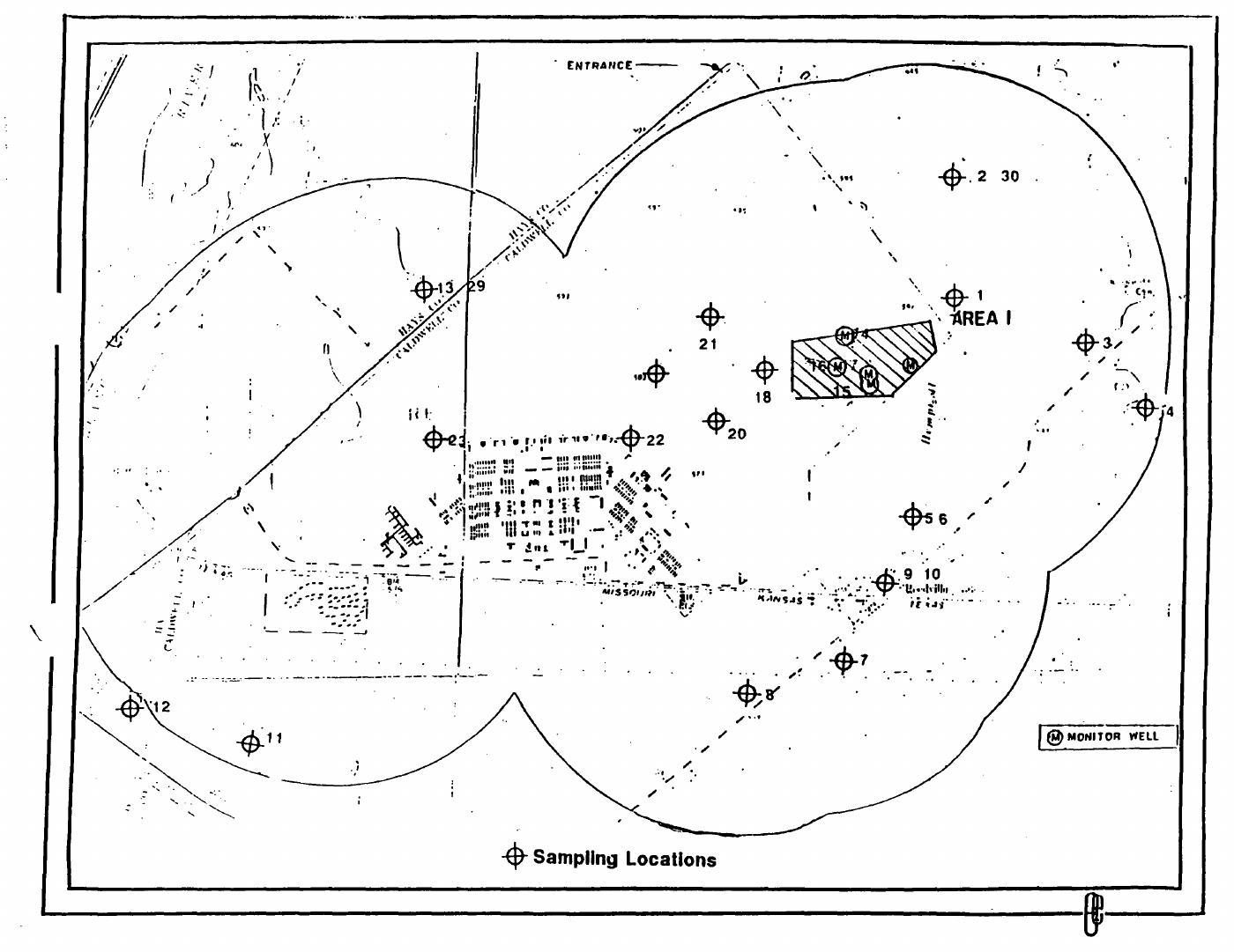
Sampling Locations Map (1995 EPA Site Inspection)
Numbered soil/groundwater sampling points and monitor wells across the site, including hatched "Area I."
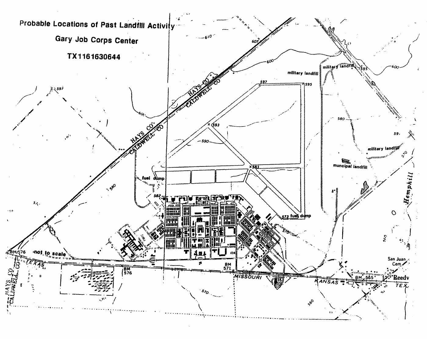
Probable Locations of Past Landfill Activity (1995 EPA Site Inspection)
Labels two separate "military landfill" locations and two "fuel dump" sites, in addition to the municipal landfill.
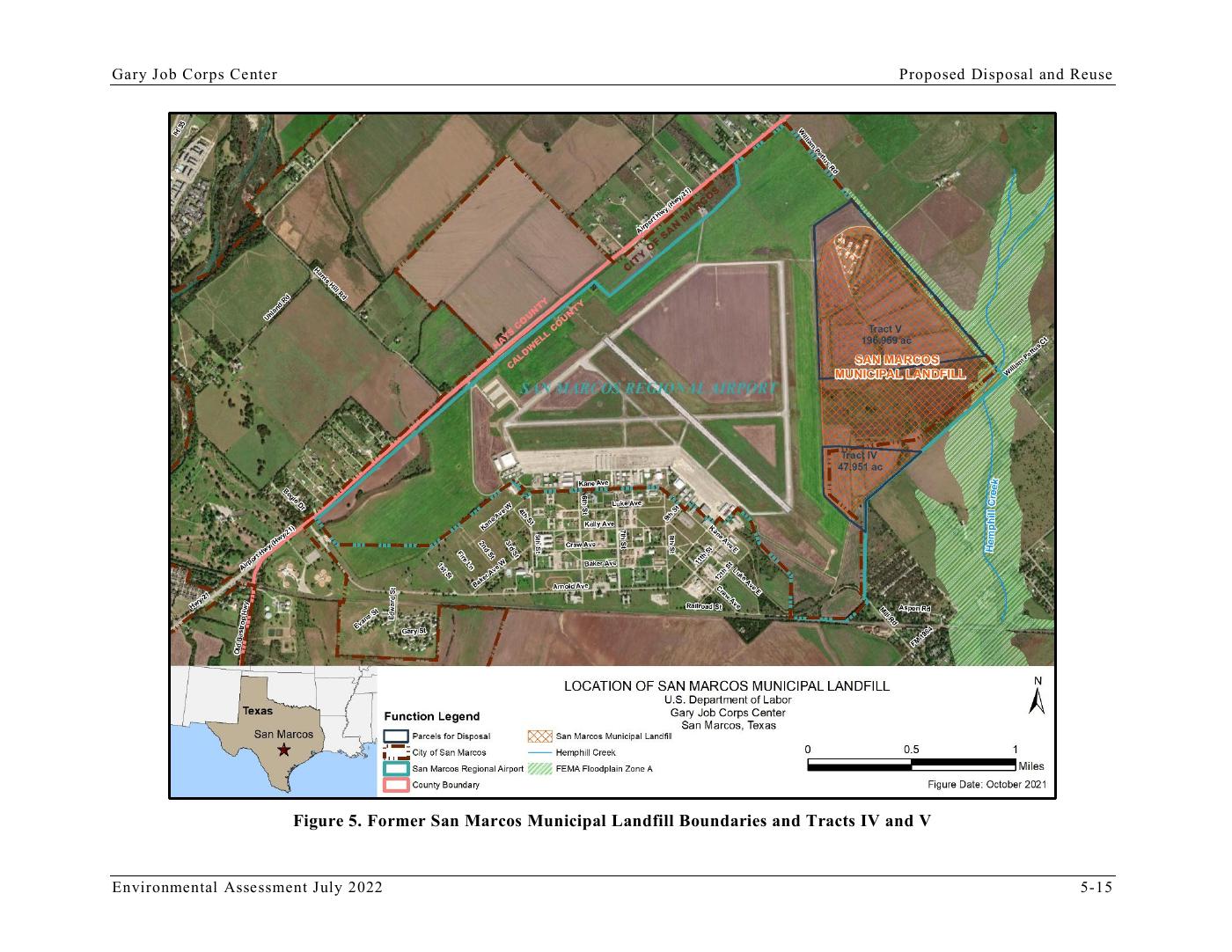
Former Landfill Boundaries & Tracts IV/V (2022 DOL Environmental Assessment, Figure 5)
Modern aerial map overlaying the former San Marcos Municipal Landfill boundary on Job Corps Tracts IV and V, alongside Hemphill Creek and FEMA Floodplain Zone A.